Command, Coordinate, & Respond,
All in One System
When seconds matter, your software shouldn’t slow you down.
RedAlert gives your crew instant access to CAD-integrated dispatch, live responder data, pre-plan maps, and hydrant locations all in one place.
Whether it’s NFIRS today or NERIS tomorrow, we’ve built the reporting backbone to help your team respond better and document faster without the mess.
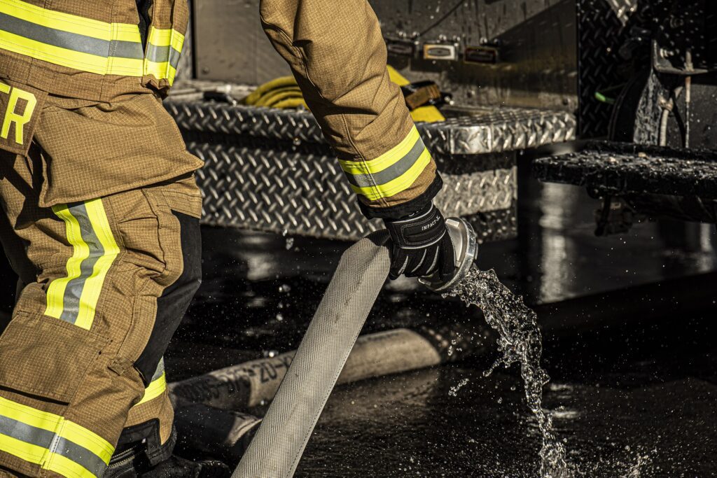

CAD Integration
Get smarter dispatch, faster response, and complete documentation. RedAlert connects with your CAD system in real time so your team knows where to go, what’s happening, and what’s needed before they arrive.
Live incident data delivered to mobile devices and stations
No more relying on expensive radios and inconsistent audio recordings
Improved situational awareness between field and command
Accurate reporting with CAD-linked incident logs

NFIRS 5.0 & NERIS-Ready Incident Reporting
RedAlert makes incident documentation fast, accurate, and fully compliant with tools that adapt to your department’s needs. Capture every detail using custom fields, automated workflows, and CAD/hardware integrations with no workarounds required.
Features
Manpower Tracking
Monitor crew activity and availability in real time.
Response Times
Report and review turnout and arrival times with precision.
Investigations
Align reporting with best-practice safety benchmarks.
NFPA Standards
Document and analyze incidents to improve prevention.
EMS & ePCR Compatibility
RedAlert supports simple, streamlined ePCR inputs and captures only the EMS data you need.

Mobile Response
Turn every phone into a command post with all of your response tools on-the-go. Our Responder mobile app provides firefighters live access to incident data, maps, crew locations, and building layouts right from the field.
- Respond to calls and stay connected with dispatch and your crew
- Real-time location and response tracking
- Live incident updates and scene maps with personnel & apparatus pins
- View preplan data, hydrants, hazards, and unit status
- See who’s en route, who’s on scene, and where they are

Customizable Mapping
RedAlert puts real-time, incident-specific maps in the hands of your crew complete with building layouts, hydrants, Knox boxes, FDC connections, and known hazards. Our custom mapping gives your team the spatial awareness they need to move with speed and precision—before they arrive on scene.
- Live map overlays with structural details, hazard zones, driveway length, FDC locations, mile markers, knox boxes, and more
- Incident-based visuals to guide deployment and reduce response time
- Pre-plans and routing info for safer, more informed navigation
- Hazard and evacuation data to support proactive risk management

Preplans
The Property and Preplan Module helps responders know what to expect before arrival. Plot hydrants, access points, Knox Boxes, and hazards while linking to detailed occupancy and construction info. First-due crews see exactly what they need on mobile or bulletin board displays.
- View preplans, run cards, and layouts in one click
- Attach building diagrams, HazMat, and contact lists
- Rapid search by address, range, or landmark
- Direct CAD and incident history integration
- Property records sync with your fire prevention team, so your occupancy data is always up to date

Hydrant Plotting
With RedAlert, hydrant data and points of interest are mapped and synced with your dispatch and preplan system. Capture flow rates, test results, GPS locations, and maintenance status for every hydrant. This ensures responders have the closest water source info right on their map when it counts.
- Link primary/secondary/tertiary hydrants to addresses
- Track inspections, repairs, and ISO-ready flow testing
- Map hydrants in GIS with alert integration
- Auto-display affected properties when hydrants are down
- Plot alternative water sources, like lakes and ponds

Automatic Vehicle Locator
Track and manage your fleet in real-time with RedAlert’s built-in vehicle command tablet. Integrated tools help your team see unit status, location, and ETA at a glance, without switching between systems. Stay mission-ready with connected vehicle intelligence that improves response and coordination from station to scene.
- Live GPS tracking of all apparatus and units
- Real-time status updates and route tracking
- In-vehicle MDT screen interface with routing, notes, and navigation
- Seamless CAD integration and unit-to-unit messaging
- Auto-syncs with incident command, dispatch, and call records